Am I at Risk?
Know your Zone!
Tsunamis can affect any part of the coast of California. Impacts to regions will depend on the location and size of the earthquake generating a tsunami and the configuration of the coastline locally. If the origin was nearby, time to take action is short. If the tsunami originated across the ocean, time to respond will be longer.
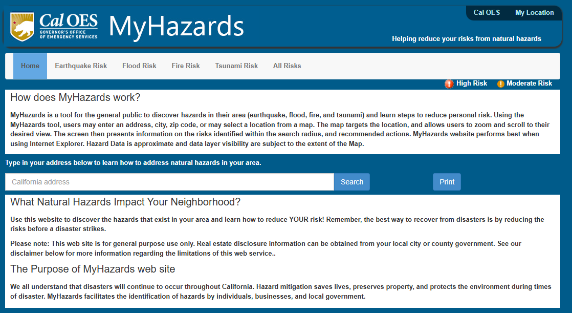
Knowing if you live, work, shop, vacation, or drop your children off for school in an area that could be impacted by a tsunami is the first step you can take to reducing your risk of injury or decreasing your property damage from the tsunami. As long as you have an address, you can find out if you are at risk by visiting Cal OES’s “My Hazards” and entering your address.
Once you determine your risk, you can begin to prepare your family, employees, students and others to lessen the impacts of an earthquake.
Hazard Area Maps
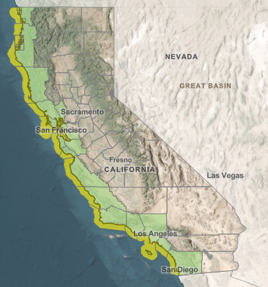
It is also important to “know your zone!” If you live on or near the coast, or if you visit the coast be sure to inform yourself on where the tsunami risk exists by examining the Tsunami Hazard Area Maps. The California Geological Survey prepared the Tsunami Hazard Area (shaded yellow on map) to assist cities and counties identify the potential tsunami hazard for tsunami response planning. The hazard area represents the maximum considered tsunami runup from several extreme, infrequent, and realistic tsunami sources. These data are intended for local jurisdictional, coastal emergency planning uses only, but they are available to the public.
Know your Zone!
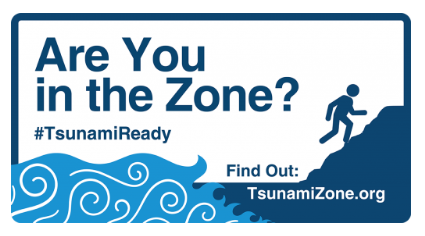
Everyone, everywhere should know how to be prepared for tsunamis and what to do to be safe. This is true for people who live or work near the ocean, but also for anyone who may visit someday. Are you in the Zone?
TsunamiZone.org provides suggestions and resources for your family or organization to “know your zone” and to learn how to be safe.