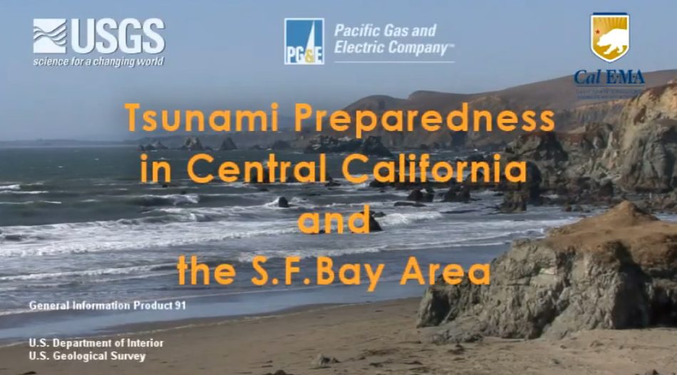
Tsunami Preparedness
What is a tsunami?
A tsunami is a series of large ocean waves often generated by large undersea earthquakes, landslides or volcanic eruptions. When the waves enter shallow depths near a coastline, they may rise to several feet or, in rare cases, tens of feet. If you are on a beach or in low coastal areas it is imperative you are aware that a tsunami could arrive within minutes after a severe earthquake. A tsunami’s danger period can continue for many hours after a major earthquake. Tsunamis can occur during any season of the year and at any time, day or night.
What does Cal OES do for tsunamis?
The California Governor’s Office of Emergency Services, Earthquake, Tsunami and Volcano Program is continuously researching, learning, and collaborating with science, industry, and academic experts to develop and confirm the latest, best available knowledge base to help make California’s residents and visitors safer in the event of tsunamic activity. By mapping potential inundation and evacuation areas, providing assistance in response and evacuation planning, implementing outreach, education and warning signage at the coast, as well as determining ways to improve preparedness and resilience of California’s ports and harbors, our staff strives to ensure everyone on the coast remains safe before, during and after the next tsunami.
About Tsunamis
Causes of Tsunamis
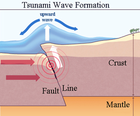 A tsunami is a series of large ocean waves often generated by landslides, volcanos, but most of ten, a large undersea earthquake that displace the ocean floor. Any disturbance in the ocean that causes the displacement of large amounts of water could result in a tsunami. Not all earthquakes generate a tsunami. To generate tsunamis, earthquakes must occur underneath or near the ocean, be of a large magnitude, and create vertical movement of the sea floor.
Generally, earthquakes on strike-slip faults, such as the San Andreas, do not by themselves generate tsunamis. In some instances, large strike-slip fault earthquakes may trigger landslides which could cause a local tsunami.
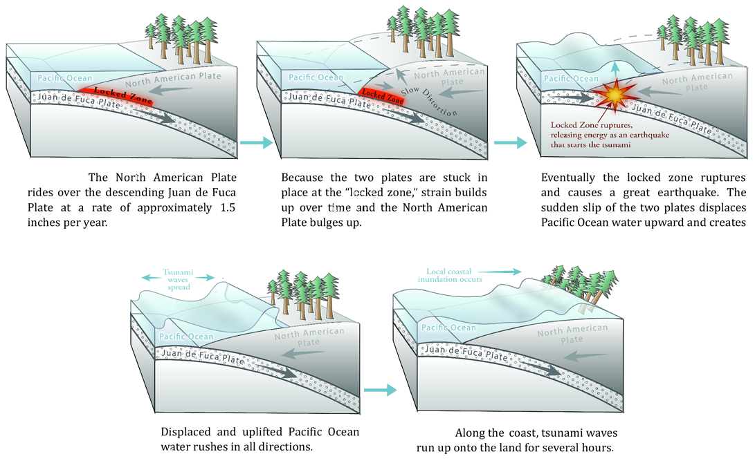
Most tsunamis are caused by earthquakes generated on a subduction zone, an area where one tectonic plate is forced under another plate. In subduction zones one plate is forced down and an adjacent plate is forced up causing an earthquake. The movement of the plates displaces water on the ocean floor vertically, resulting in a wave which then propagates horizontally through and across the entire ocean.
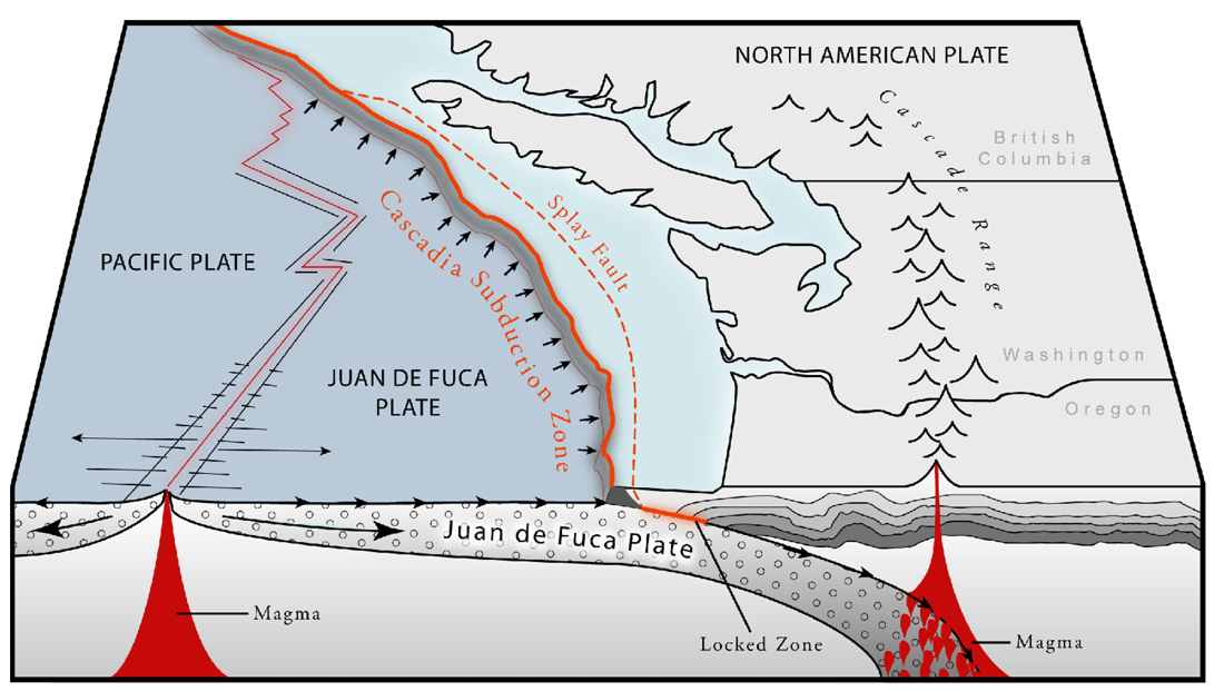
Cascadia Tsunamis – California’s Near Source
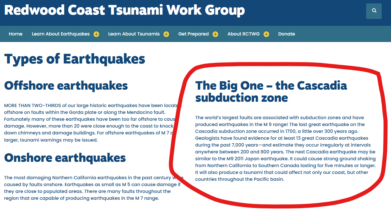
Eventually, water rushes landward and may flood the shoreline resulting in inundation of dry land. While tsunamis can occur in any oceanic region in the world, large earthquakes take place on the Pacific Ocean basin than anywhere else. For more information on a Cascadia earthquake and tsunami please visit The Big One – Cascadia by the Redwood Coast Tsunami Work Group. Also, see You Live in Earthquake Country for more information about Earthquakes in Northern California.
Distant Source Tsunamis
After an event on the ocean floor (earthquake, landslide, volcanic eruption) displaces water, a wave is formed which travels out from where the event occurred. Some of the water travels across the ocean basin. Scientists refer to this event as a “distant source tsunami”. Distant source tsunamis usually provide more time than near source tsunamis for warning and preparation.
During distance source tsunamis, you may receive official instructions from your local government officials through the media.
Near Source Tsunami
 Near source tsunamis are caused when a subduction zone (such as Cascadia) is immediately offshore from your location. They can be more dangerous as they are closer to shore and can reach your shoreline within minutes of the originating earthquake. They may also be larger than a wave coming from across the ocean when they do strike, as their energy has not had time nor distance to dissipate. Near source tsunamis provide little to no time for warning, evacuation, first responder preparation and dangerous circumstances for response.
For near source tsunamis, do not wait for official warnings to evacuate. Strong shaking and other natural warning signs are your indicators that a tsunami could be on the way.
Keep Learning
Learn more about tsunamis from the National Oceanic and Atmospheric Administration (NOAA).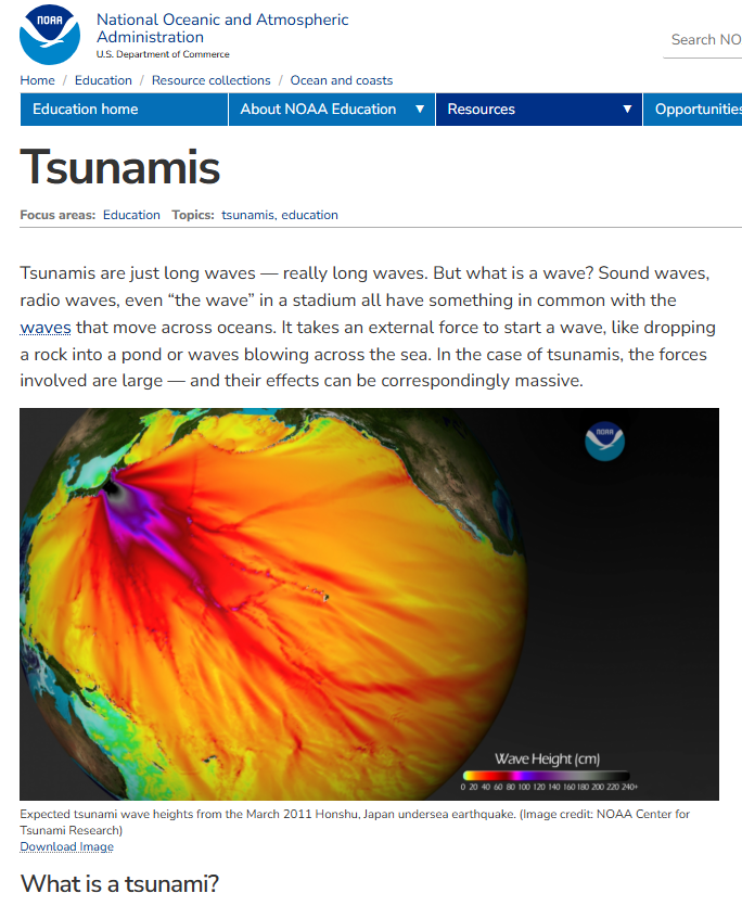
Tsunami Warning Information
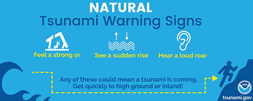
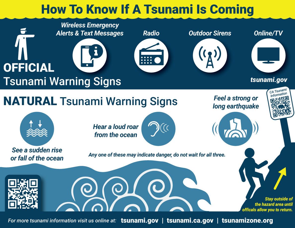
Natural warnings may occur prior to a tsunami. In a local source earthquake tsunami, the earthquake is the warning to get to high ground and may occur only a few minutes
prior to tsunami impact. There will be no natural warning for a distant source tsunami. Knowing what to watch for, how to react and where to go in the event of a tsunami is the most effective way to know how to protect yourself and your family. The bottom line is:
- Be Aware When at the coast know where safe, high ground is located.
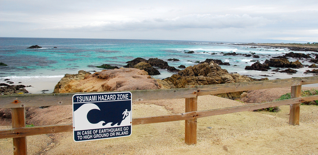
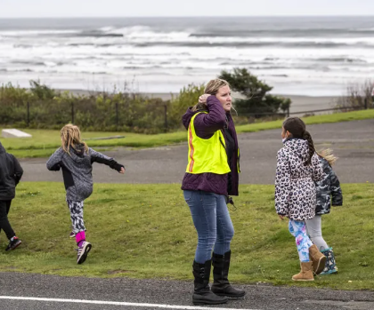
- Drop, Cover, Hold On, Go Up When you are near the shore and feel a strong ground shaking that lasts a long time, drop, cover and hold on until the shaking stops. If you are on the coast, the earthquake may have caused a tsunami nearby which could arrive at your location in as little as 5-10 minutes. Go immediately to higher ground or inland (avoiding river valleys). If you are in a tsunami zone marked by signs, follow posted signs to a safe area.
- Unusual Sea Level Fluctuations A noticeable rapid rise or fall in coastal waters is a sign that there may be a tsunami approaching. If you see the water draw out to sea quickly and unexpectedly from a beach exposing the ocean floor (the so-called drawback) or a sudden rise of the sea level, escape immediately to higher ground or inland (avoiding river valleys). If you are in a tsunami zone marked by signs, follow posted signs to a safe area.
- Loud Roar If you hear a loud ocean roar, similar to that of a train or jet aircraft, a tsunami may be approaching, so escape immediately to higher ground or inland (avoiding river valleys). If you are in a tsunami zone marked by signs, follow posted signs to a safe area.
If you observe any of these natural warning signs OR authorities alert you, a tsunami may arrive in minutes and last for eight hours or longer. Never return to the shore until you are given the “all clear” from a reliable source.
 Most tsunamis are not one big breaking wave that overruns the shore. They are usually a series of waves behaving similar to a rapidly rising high tide that can continue repeatedly over many hours, and even days. In most cases, the first in the series of waves is not the biggest. A tsunami may start small, relatively speaking, and develop over time. People have been killed most often by subsequent waves, coming hours after the “start of tsunami.” Tsunamis travel faster over the open ocean than they do toward land. In the open ocean the travel a speeds of up to 600 mph, about the speed of a jet. Not all tsunamis are recognizable by the fast recession of water from the shore. Only about 40% of tsunamis produce this natural warning sign.
Knowing this information will allow you to react more quickly and safely when a tsunami is expected. Please visit our partner websites for more information.
What do I do if I’ve been alerted of a tsunami?
Information about active tsunami events can be found through the US Tsunami Warning Center.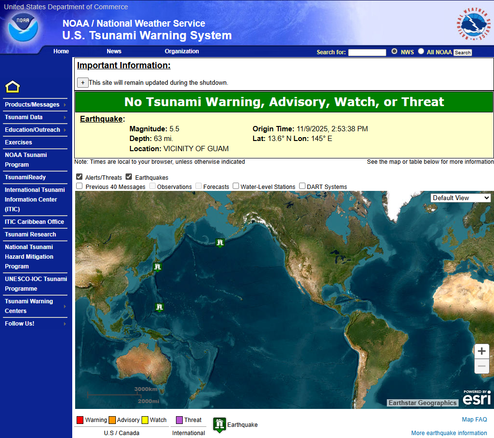
Am I at Risk?
Know your Zone!
Tsunamis can affect any part of the coast of California. Impacts to regions will depend on the location and size of the earthquake generating a tsunami and the configuration of the coastline locally. If the origin was nearby, time to take action is short. If the tsunami originated across the ocean, time to respond will be longer.
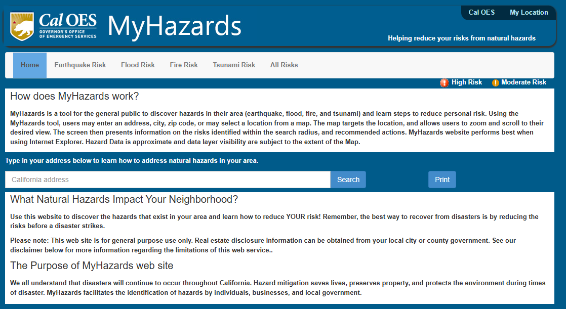
Knowing if you live, work, shop, vacation, or drop your children off for school in an area that could be impacted by a tsunami is the first step you can take to reducing your risk of injury or decreasing your property damage from the tsunami. As long as you have an address, you can find out if you are at risk by visiting Cal OES’s “My Hazards” and entering your address.
Once you determine your risk, you can begin to prepare your family, employees, students and others to lessen the impacts of an earthquake.
Hazard Area Maps
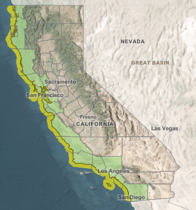
It is also important to “know your zone!” If you live on or near the coast, or if you visit the coast be sure to inform yourself on where the tsunami risk exists by examining the Tsunami Hazard Area Maps. The California Geological Survey prepared the Tsunami Hazard Area (shaded yellow on map) to assist cities and counties identify the potential tsunami hazard for tsunami response planning. The hazard area represents the maximum considered tsunami runup from several extreme, infrequent, and realistic tsunami sources. These data are intended for local jurisdictional, coastal emergency planning uses only, but they are available to the public.
Know your Zone!
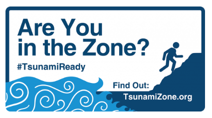
Everyone, everywhere should know how to be prepared for tsunamis and what to do to be safe. This is true for people who live or work near the ocean, but also for anyone who may visit someday. Are you in the Zone?
TsunamiZone.org provides suggestions and resources for your family or organization to “know your zone” and to learn how to be safe.
Be Prepared for a Tsunami
Be Prepared, Not Scared!
Preparedness refers to activities we do prior to a tsunami to be ready to respond to and recover from significant tsunamis. When it comes to tsunamis, there are simple things you can do to improve the chances you and your loved ones will survive and recover. Anything you do today will be like making a deposit in your survivability savings account for withdrawal in tough times.
Videos
What can I do?
One of the first actions you can take to protect your family is to learn when there is potential for a tsunami.
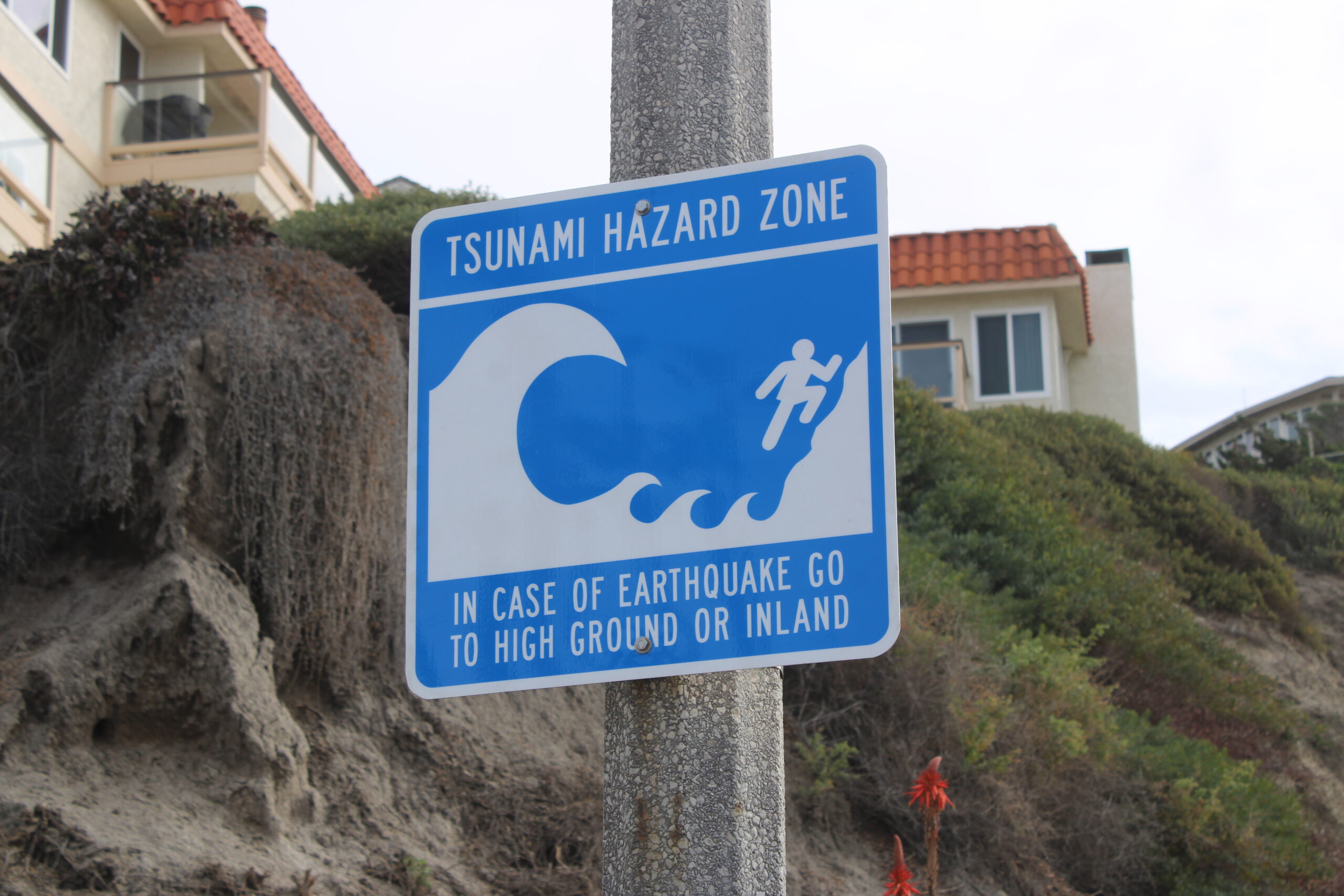
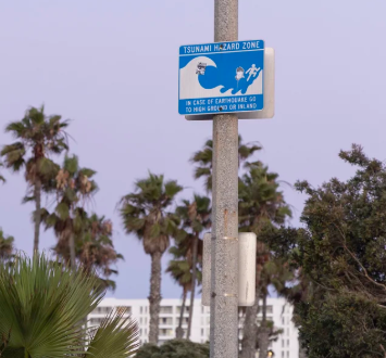
Tsunami hazard warning signs near San Clemente State Beach.
If you are at risk for a tsunami, it is recommended you:
- Plan an evacuation route from your home, school, workplace, or anywhere else you may go that is at risk, for a tsunami. You should be able to reach your safe location on foot within 15 minutes as roads may become impassible or blocked. Local emergency management officials can help advise you of the best route for safety and potential shelter locations.
- Practice your evacuation route. Familiarity may save your life. Be able to follow your escape route at night and during inclement weather. Practicing your plan makes the appropriate response more of a reaction, requiring less thinking during an actual emergency situation.
- Use a NOAA Weather Radio with a tone-alert feature to keep you informed of local watches and warnings. The tone alert feature will warn you of potential danger even if you are not currently listening to local radio or television stations.
- Talk to your insurance agent. Homeowners’ policies do not cover flooding from a tsunami. Ask about the National Flood Insurance Program.
- Discuss tsunami with your family. Everyone should know what to do in case all family members are not together. Discussing tsunamis ahead of time will help reduce fear and anxiety and let everyone know how to respond. Review flood safety and preparedness measures with your family.
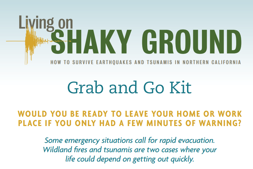
If your home is in or near a tsunami zone, you should be prepared to remain evacuated for at least three days (72 hours). Do not return to low-lying coastal areas after an initial tsunami wave has arrived as other waves or surges are likely to follow the first one and each wave cycle can last approximately 20-30 minutes. Dangerous tsunami wave activity can last for many hours and even days. Keep a disaster kit handy in your home, your car, and in your workplace. See Earthquake Country Alliance’s 7 Steps to Earthquake Safety here.
For more information on how to prepare for tsunamis, visit our “Tools and Resources” section.
Preparing Your Workplace
According to the U.S. Bureau of Labor Statistics, American Time Use Survey, in 2013 the average work day for full time employed Americans (age 25-54 with children) was 8.7 hours. A tsunami could occur anytime in that 8.7 hours. Are you prepared? Preparing your workplace is just as important as preparing your home. There are many ways to improve your safety in the event of a tsunami. Here are just a few suggestions:
Click to learn more.
- Know if your workplace is in a tsunami hazard zone. Visit “My Hazards” and enter the address location.
- Be familiar with your company’s emergency plan.
- Know your local evacuation routes and evacuation sites.
- Keep a pack of personal supplies (including walking shoes) that can be grabbed quickly and easily.
- Keep a list of emergency numbers handy.
- Listen to your radio for safety updates and an official “all clear” message before returning.
For more ideas and information about preparing your workplace, visit the “Tools and Resources” section.
Tsunami Preparedness for Businesses and Organizations
 A workplace should follow accepted tsunami safety guidelines, but have in place a personalized, well-rehearsed plan to minimize injury and damage during a tsunami. Developing, and putting into place, a Disaster Plan will not only protect employees but will help minimize the financial impact of a tsunami and help you recover more quickly.
Many organizations play a role in assisting business owners with their disaster planning. See our “Tools and Resources” section below to get started preparing before the next earthquake with sample plans, checklists, suggested educational programs for employees, exercise methods, and how to improve plans that are already in place.
Tsunami Preparedness for Teachers and Schools
While tsunamis have occurred throughout history, our knowledge and understanding of preparing for them is much more informed in recent years due to advances in science and technology to study them. More than 70 tsunamis have impacted California in the past 150 years, with recent impacts occurring in 2011, 2010, 2009, 2006, 1964, and 1960.
Through planning and education, we are increasingly in a position to ensure the current and upcoming generations make tsunami preparedness a regular part of their routine. As actions from learning to identify areas at risk of tsunami to practicing a “tsunami walk” become the norm, students can take this information and teach their families and friends.
As we learn more, our partners are applying that knowledge to assist teachers, parents and schools in the education of students of all ages and abilities by providing lesson plans, curriculum, activities, games, materials, publications and a multitude of other resources. The Next Generation Science Standards (NGSS) address natural hazards including tsunamis, so teachers can help plan lessons that meet education standards.
San Diego County OES – Tsunamis: Know What to Do!
For easy access to resources for teaching about tsunamis, see our “Tools and Resources” section below.
Tsunami Preparedness for Government Agencies and Tribes
The Earthquake, Tsunami and Volcano Program is responsible for the supporting all California governmental agencies to ensure the protection and safety of the populace in the event of an tsunami. To this end, the Program staff are available to provide guidance and assistance to our partners in the preparation of plans to mitigate and plan for, respond to and recover from tsunamis impacting our State. In addition, many resources and guidance materials are available for review in the “Tools and Resources” Section below to walk developers through the planning process.
Being Tsunami Ready
 Check out the video prepared by the California Geological Survey about Tsunami Hazards.
Understanding Tsunami Signage
Most emergency management agencies responsible for areas along the California coast went through a vigorous process to identify tsunami hazard zones and then placed signs in specific areas to delineate the perimeter of the inundation zone, evacuation routes and appropriate action to be taken by individuals when an earthquake occurs.
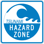 |
If you see a Tsunami Hazard Zone sign, you are in an area that could, potentially, be inundated by a tsunami. Upon seeing this sign, identify possible locations to which you will travel when the water starts moving. |
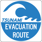 |
The Tsunami Evacuation Route sign is used with arrows to direct individuals toward a safe area. When evacuating after an earthquake, follow the arrows until reaching an evacuation site. These signs can be found on state highways as well as local streets and roads. |
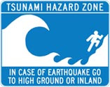 |
The signs indicating you are in a tsunami hazard zone and should go to high ground or inland in the event of an earthquake are generally located near the immediate coastline, in parking lots, at parks and beaches. When seeing this sign, be prepared by taking note of the location to which you will go after an earthquake. In most cases, safe, high ground is reachable by foot. |
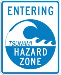 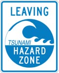 |
The Entering/Leaving Tsunami Hazard Zone sign is used to delineate the boundary of defined inundation areas on State highways, local street and roads. You are considered safe, and out of the tsunami hazard zone, if moving inland away from the coast, from these signs. |
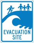 |
Signs designating an Evacuation Site may be used to direct road users (including pedestrians and bicyclists) to safe areas. Such a sign is further confirmation that you’ve reached safe, high ground. |
Tsunami Debris
Tsunami Damage and Exposure
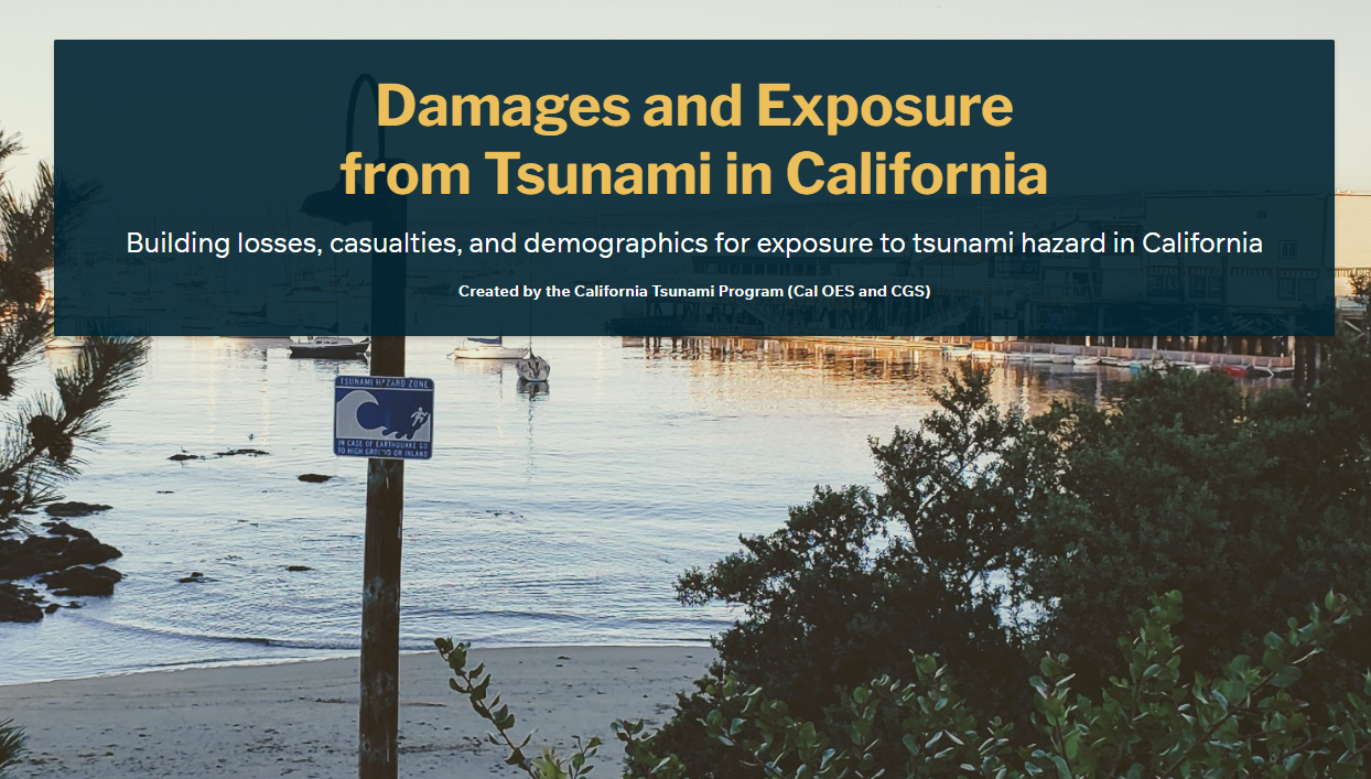 The California Tsunami Program has developed customized reports for possible tsunami damages and exposure in California. These results can be used to support emergency management decision-making for tsunami event planning and response.
The tsunami damage and exposure results are a first-of its-kind for California and provide consistent population exposure and loss estimates using the best-available methods and data. These results are provided at the County and State-levels to provide resources for tsunami planning for emergency management at both the local and state-wide levels.
An interactive dashboard and County-level summary sheets for the tsunami damage and exposure results are available here.
Tsunami Debris
When a tsunami strikes, it doesn’t just bring water, it can also carry massive amounts of debris. This includes everything from small building materials to large objects like cars, boats, and shipping containers. These floating items can damage infrastructure, block evacuation routes, and greatly increase cleanup costs. Learn more!
(Link to Pat’s work)
Tsunami Maritime Information
Maritime Guidance and Recovery
Cal OES has prepared an extensive resource to assist boaters in the event of a tsunami. See the Tsunami Maritime Guidance site for more information. 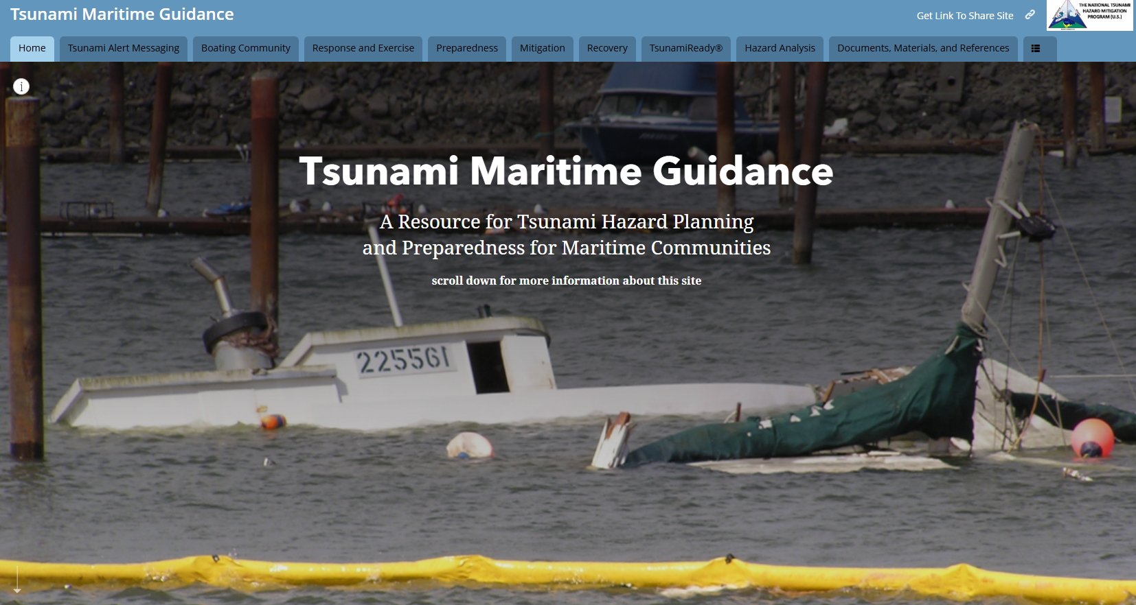
Tsunami T-stories
Tsunami History in California
Maritime Guidance and Recovery
Tools and Resources
- California Tsunami Hazard Zone Maps by County (CGS)
- Latest Tsunami Event Information (NOAA/NWS)
- SAFRR Tsunami Ocean Height Simulation in Ports of LA/LB (USGS)
Publications
- Tsunami SAFRR Scenario Report (USGS)
- Tsunami Glossary (ITIC)
- Why Talk About Tsunamis? (Disaster Center)
- Community Exposure to Tsunamis in California (USGS)
- Damages and Exposure from Tsunami in California (Cal OES)
Planning and Preparedness Websites
- National Tsunami Hazard Mitigation Program (NOAA)
- Planning and Preparedness (CalOES)
- Tsunami Ready.gov (FEMA)
- NWS TsunamiReady® Program (NOAA)
- TsunamiZone.org (CalOES)
- Tsunamis: California Geological Survey
- Redwood Coast Tsunami Work Group
- Tsunami Maritime Resources Website (NTHMP)
For Schools and Educators
- Tsunami Education Materials (CGS)
- The Extraordinary Voyage of Kamome: A Tsunami Boat Comes Home, Kamome Curriculum
For Businesses and Organizations
- Emergency Management Guide for Business and Industry (FEMA)
- Emergency Preparedness Checklist for Small Businesses (FedEx/ARC)
- Emergency Preparedness Resources for Business (FEMA)
- The Business and Industry Council for Emergency Planning and Preparedness (BICEPP)
- Ready.gov Business (FEMA)
- U.S. Small Business Administration (SBA)
- U.S. Department of Homeland Security
- Disaster Resistant Business Toolkit
Partners
- American Red Cross (ARC)
- California Geological Survey (CGS)
- Federal Emergency Management Agency (FEMA)
- National Tsunami Hazard Mitigation Program (NOAA)
- National Tsunami Warning Center, Alert & Warning notification (NTWC)
- Pacific Marine Environmental Laboratory (NOAA)
- Redwood Coast Tsunami Work Group
- United States Geologic Survey (USGS)
- Western States Seismic Policy Council (WSSPC)
Get Connected!
You can get earthquake and tsunami information and alerts sent to your phone! Be sure you are signed up.
Download MyShake for earthquake alerts provided in partnership with the United States Geological Survey and Cal OES. This can give you critical seconds to get safe and ready to Drop, Cover and Hold On.