Index of /wp-content/uploads/sites/6/2012/08
Name
Last modified
Size
Description
Parent Directory
-
20120821-082524.jpg
2026-03-20 00:53
3.7M
fire-map-0900-8-23-12.jpg
2026-03-20 00:53
1.8M
statewide_fires_20120822_0800.pdf
2026-03-20 00:53
1.7M
statewide_fires_20120821_0800.pdf
2026-03-20 00:53
1.6M
press-conf-ss.png
2026-03-20 00:53
1.3M
statewide_fires_20120820_1900.pdf
2026-03-20 00:53
1.2M
statewide_fires_20120820_1900.jpg
2026-03-20 00:53
1.0M
screen-shot-2012-08-29-at-6-26-12-pm.png
2026-03-20 00:53
1.0M
statewide_fires_20120826_0800.jpg
2026-03-20 00:53
927K
statewide_fires_20120825_07303.jpg
2026-03-20 00:53
920K
statewide_fires_20120825_07302.jpg
2026-03-20 00:53
920K
statewide_fires_20120825_07301.jpg
2026-03-20 00:53
920K
statewide_fires_20120825_0730.jpg
2026-03-20 00:53
920K
1acres-burned-per-year-nationally-copy.png
2026-03-20 00:53
796K
prepkits2.jpg
2026-03-20 00:53
766K
press-conf-ss-1024x575.png
2026-03-20 00:53
750K
screen-shot-2012-08-29-at-6-26-12-pm-1024x652.png
2026-03-20 00:53
746K
196949f8-8cd4-4ef1-8fd3-3ba9756472f0.png
2026-03-20 00:53
674K
1fires-per-year-nationally1.png
2026-03-20 00:53
581K
1fires-per-year-nationally.png
2026-03-20 00:53
581K
screen-shot-2012-08-13-at-3-42-14-pm.png
2026-03-20 00:53
568K
comparison.png
2026-03-20 00:53
567K
statewide_fires_20120822_0800.jpg
2026-03-20 00:53
520K
screen-shot-2012-08-20-at-8-43-10-pm.png
2026-03-20 00:53
502K
statewide_fires_20120821_0800.jpg
2026-03-20 00:53
496K
firemap_08-28-12.jpg
2026-03-20 00:53
451K
firemap_08-27-12.jpg
2026-03-20 00:53
447K
fire-update.jpg
2026-03-20 00:53
446K
tsunami-watch-vs-warning-02.jpg
2026-03-20 00:53
430K
dsc_0318.jpg
2026-03-20 00:53
372K
3e8dcc78-6073-49c0-87bf-5700c53e0737.png
2026-03-20 00:53
339K
screen-shot-2012-08-10-at-10-27-02-am-1024x820.png
2026-03-20 00:53
338K
20120821-082524-768x1024.jpg
2026-03-20 00:53
331K
screen-shot-2012-08-29-at-6-40-15-pm.png
2026-03-20 00:53
330K
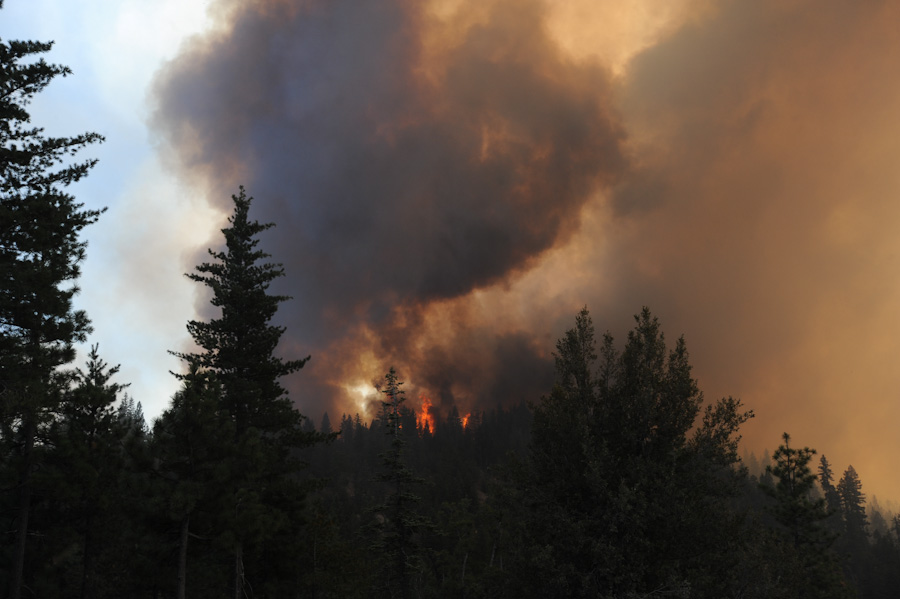
jts_9087.jpg
2026-03-20 00:53
318K
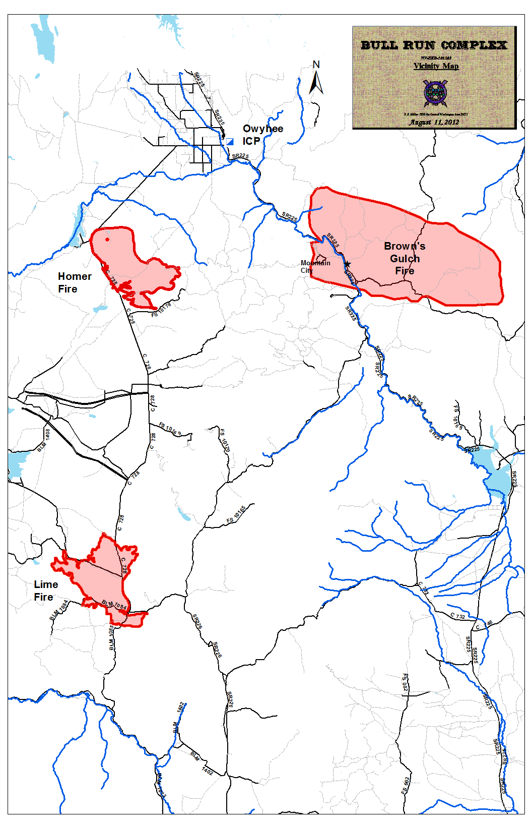
bull-run-complex-nv-map-2012-08-12-663x1024.png
2026-03-20 00:53
317K
prepkits2-1024x683.jpg
2026-03-20 00:53
285K
screen-shot-2012-08-10-at-10-27-02-am.png
2026-03-20 00:53
263K
dsc_0098.jpg
2026-03-20 00:53
234K
fire-map-0900-8-23-12-791x1024.jpg
2026-03-20 00:53
218K
20120821-070942.jpg
2026-03-20 00:53
217K
tsunamisign.jpg
2026-03-20 00:53
216K
20120821-071037.jpg
2026-03-20 00:53
211K
20120821-071010.jpg
2026-03-20 00:53
211K
dsc_0436.jpg
2026-03-20 00:53
209K
20120821-072429.jpg
2026-03-20 00:53
209K
dsc_0342.jpg
2026-03-20 00:53
204K
dsc_0330.jpg
2026-03-20 00:53
201K
fire-update-1024x683.jpg
2026-03-20 00:53
200K
20120821-070942-1024x768.jpg
2026-03-20 00:53
194K
tsunami-watch-vs-warning-02-756x1024.jpg
2026-03-20 00:53
192K
20120821-071037-1024x768.jpg
2026-03-20 00:53
188K
20120821-071010-1024x768.jpg
2026-03-20 00:53
188K
20120821-072429-1024x768.jpg
2026-03-20 00:53
187K
statewide_fires_20120822_0800-791x1024.jpg
2026-03-20 00:53
182K
comparison-1024x600.png
2026-03-20 00:53
178K
statewide_fires_20120820_1900-791x1024.jpg
2026-03-20 00:53
178K
pondersa-fire.jpg
2026-03-20 00:53
175K
statewide_fires_20120821_0800-791x1024.jpg
2026-03-20 00:53
174K
screen-shot-2012-08-13-at-3-42-14-pm-300x298.png
2026-03-20 00:53
168K
fire-chart1.jpg
2026-03-20 00:53
166K
fire-chart.jpg
2026-03-20 00:53
166K
large.jpg
2026-03-20 00:53
163K
large-1024x768.jpg
2026-03-20 00:53
163K
statewide_fires_20120826_0800-791x1024.jpg
2026-03-20 00:53
161K
statewide_fires_20120825_07303-791x1024.jpg
2026-03-20 00:53
159K
statewide_fires_20120825_07302-791x1024.jpg
2026-03-20 00:53
159K
statewide_fires_20120825_07301-791x1024.jpg
2026-03-20 00:53
159K
statewide_fires_20120825_0730-791x1024.jpg
2026-03-20 00:53
159K
firemap_08-28-12-791x1024.jpg
2026-03-20 00:53
157K
1acres-burned-per-year-nationally-copy-1024x585.png
2026-03-20 00:53
157K
bull-run-fire-nv-01.jpeg
2026-03-20 00:53
157K
firemap_08-27-12-791x1024.jpg
2026-03-20 00:53
155K
1fires-per-year-nationally1-1024x589.png
2026-03-20 00:53
150K
1fires-per-year-nationally-1024x589.png
2026-03-20 00:53
150K
196949f8-8cd4-4ef1-8fd3-3ba9756472f0-300x217.png
2026-03-20 00:53
149K
oes-strike-team-chips-fire.jpeg
2026-03-20 00:53
143K
bull-run-complex-nv-map-2012-08-12.png
2026-03-20 00:53
142K
screen-shot-2012-08-20-at-8-43-10-pm-300x300.png
2026-03-20 00:53
139K
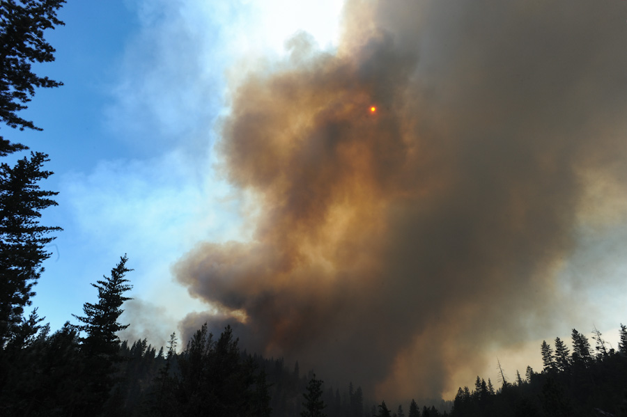
jts_9253.jpg
2026-03-20 00:53
138K
jts_9213.jpg
2026-03-20 00:53
138K
dsc_0597.jpg
2026-03-20 00:53
134K
jts_9269.jpg
2026-03-20 00:53
124K
3e8dcc78-6073-49c0-87bf-5700c53e0737-211x300.png
2026-03-20 00:53
124K
dsc_0484.jpg
2026-03-20 00:53
119K
bull-run-fire-nv-01-1024x768.jpeg
2026-03-20 00:53
111K
timber-ponderosa-fire-768x1024.jpg
2026-03-20 00:53
110K
fireflower.jpg
2026-03-20 00:53
104K
screen-shot-2012-08-29-at-6-26-12-pm-300x191.png
2026-03-20 00:53
97K
screen-shot-2012-08-20-at-1-45-42-pm.png
2026-03-20 00:53
96K
dogbuns.jpg
2026-03-20 00:53
96K
fire-chart1-1024x480.jpg
2026-03-20 00:53
92K
fire-chart-1024x480.jpg
2026-03-20 00:53
92K
prepkits2-300x200.jpg
2026-03-20 00:53
91K
timber-ponderosa-fire.jpg
2026-03-20 00:53
90K
press-conf-ss-300x169.png
2026-03-20 00:53
85K
fire-map-thumbnail-aug-20-2012.jpg
2026-03-20 00:53
84K
fc825bc8-a2ca-4866-aa84-af6528c3dfbb.png
2026-03-20 00:53
80K
screen-shot-2012-08-29-at-6-40-15-pm-300x177.png
2026-03-20 00:53
77K
screen-shot-2012-08-20-at-1-45-42-pm-300x281.png
2026-03-20 00:53
74K
dsc_0318-300x200.jpg
2026-03-20 00:53
73K
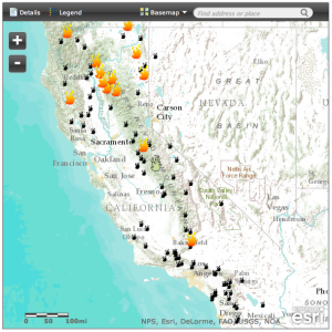
wildfire-map-82212.png
2026-03-20 00:53
72K
wildfire-map-82212-232x300.png
2026-03-20 00:53
69K
prepkits2-150x150.jpg
2026-03-20 00:53
69K
ytd_allyears_jul2012.png
2026-03-20 00:53
65K
jts_9087-300x200.jpg
2026-03-20 00:53
64K
dsc_0098-300x200.jpg
2026-03-20 00:53
62K
196949f8-8cd4-4ef1-8fd3-3ba9756472f0-150x150.png
2026-03-20 00:53
54K
dsc_0436-300x200.jpg
2026-03-20 00:53
54K
dsc_0318-150x150.jpg
2026-03-20 00:53
53K
screen-shot-2012-08-10-at-10-27-02-am-300x240.png
2026-03-20 00:53
52K
bull-run-complex-nv-map-2012-08-12-194x300.png
2026-03-20 00:53
50K
3e8dcc78-6073-49c0-87bf-5700c53e0737-150x150.png
2026-03-20 00:53
49K
screen-shot-2012-08-13-at-3-42-14-pm-150x150.png
2026-03-20 00:53
49K
jts_9087-150x150.jpg
2026-03-20 00:53
47K
wildfires-map-generic-graphic.jpg
2026-03-20 00:53
47K
dsc_0098-150x150.jpg
2026-03-20 00:53
47K
dsc_0342-300x200.jpg
2026-03-20 00:53
47K
screen-shot-2012-08-29-at-6-26-12-pm-150x150.png
2026-03-20 00:53
46K
fire-update-300x200.jpg
2026-03-20 00:53
46K
dsc_0330-300x200.jpg
2026-03-20 00:53
45K
screen-shot-2012-08-30-at-2-22-42-pm-300x203.png
2026-03-20 00:53
42K
press-conf-ss-150x150.png
2026-03-20 00:53
41K
dsc_0436-150x150.jpg
2026-03-20 00:53
41K
screen-shot-2012-08-20-at-8-43-10-pm-150x150.png
2026-03-20 00:53
39K
jts_9213-300x200.jpg
2026-03-20 00:53
39K
screen-shot-2012-08-30-at-2-22-42-pm.png
2026-03-20 00:53
38K
screen-shot-2012-08-30-at-2-19-22-pm-300x178.png
2026-03-20 00:53
38K
20120821-070912.jpg
2026-03-20 00:53
37K
inciweb-screen-grab-generic-296x300.jpg
2026-03-20 00:53
37K
pic14945.jpg
2026-03-20 00:53
37K
dsc_0484-300x200.jpg
2026-03-20 00:53
37K
jts_9253-300x200.jpg
2026-03-20 00:53
36K
kit.jpg
2026-03-20 00:53
36K
screen-shot-2012-08-29-at-6-40-15-pm-150x150.png
2026-03-20 00:53
35K
dsc_0597-300x200.jpg
2026-03-20 00:53
35K
dsc_0342-150x150.jpg
2026-03-20 00:53
35K
dsc_0330-150x150.jpg
2026-03-20 00:53
34K
calfire-incident-page-generic-296x300.jpg
2026-03-20 00:53
34K
tsunami-watch-vs-warning-02-221x300.jpg
2026-03-20 00:53
33K
statewide-map-300-pix-generic.jpg
2026-03-20 00:53
33K
inciweb-screen-grab-generic.jpg
2026-03-20 00:53
33K
jts_9269-300x200.jpg
2026-03-20 00:53
32K
fireflower-300x225.jpg
2026-03-20 00:53
32K
flexgrab580.jpg
2026-03-20 00:53
31K
calfire-incident-page-generic.jpg
2026-03-20 00:53
31K
comparison-300x176.png
2026-03-20 00:53
31K
wildfires-map-generic-graphic-300x204.jpg
2026-03-20 00:53
31K
fire-chart1-300x141.jpg
2026-03-20 00:53
31K
fire-chart-300x141.jpg
2026-03-20 00:53
31K
pic14945-300x260.jpg
2026-03-20 00:53
31K
fire-map-thumbnail-aug-20-2012-291x300.jpg
2026-03-20 00:53
29K
fire-update-150x150.jpg
2026-03-20 00:53
29K
jts_9213-150x150.jpg
2026-03-20 00:53
29K
ponderosa.jpg
2026-03-20 00:53
28K
dsc_0484-150x150.jpg
2026-03-20 00:53
28K
adobe-pdf-icon.gif
2026-03-20 00:53
27K
jts_9253-150x150.jpg
2026-03-20 00:53
27K
1acres-burned-per-year-nationally-copy-300x171.png
2026-03-20 00:53
27K
oes-strike-team-chips-fire-300x225.jpeg
2026-03-20 00:53
27K
screen-shot-2012-08-20-at-1-45-42-pm-150x150.png
2026-03-20 00:53
27K
screen-shot-2012-08-30-at-2-19-22-pm.png
2026-03-20 00:53
27K
1fires-per-year-nationally1-300x172.png
2026-03-20 00:53
26K
1fires-per-year-nationally-300x172.png
2026-03-20 00:53
26K
20120821-082524-225x300.jpg
2026-03-20 00:53
26K
dsc_0597-150x150.jpg
2026-03-20 00:53
26K
fc825bc8-a2ca-4866-aa84-af6528c3dfbb-150x150.png
2026-03-20 00:53
26K
20120821-070928.jpg
2026-03-20 00:53
26K
statewide-map-300-pix-generic-232x300.jpg
2026-03-20 00:53
26K
tsunamisign-300x200.jpg
2026-03-20 00:53
25K
fire-map-0900-8-23-12-232x300.jpg
2026-03-20 00:53
25K
wildfire-map-82212-150x150.png
2026-03-20 00:53
25K
jts_9269-150x150.jpg
2026-03-20 00:53
25K
adobe-pdf-icon-300x277.gif
2026-03-20 00:53
25K
fire-chart1-150x150.jpg
2026-03-20 00:53
24K
fire-chart-150x150.jpg
2026-03-20 00:53
24K
screen-shot-2012-08-10-at-10-27-02-am-150x150.png
2026-03-20 00:53
24K
20120821-070928-300x225.jpg
2026-03-20 00:53
23K
large-300x225.jpg
2026-03-20 00:53
23K
dogbuns-300x199.jpg
2026-03-20 00:53
22K
20120821-070942-300x225.jpg
2026-03-20 00:53
22K
20120821-070912-300x225.jpg
2026-03-20 00:53
22K
bull-run-complex-nv-map-2012-08-12-150x150.png
2026-03-20 00:53
22K
20120821-072429-300x225.jpg
2026-03-20 00:53
21K
statewide_fires_20120820_1900-232x300.jpg
2026-03-20 00:53
21K
statewide_fires_20120822_0800-232x300.jpg
2026-03-20 00:53
21K
20120821-071037-300x225.jpg
2026-03-20 00:53
20K
20120821-071010-300x225.jpg
2026-03-20 00:53
20K
statewide_fires_20120821_0800-232x300.jpg
2026-03-20 00:53
20K
screen-shot-2012-08-30-at-2-22-42-pm-150x150.png
2026-03-20 00:53
20K
july2012_wildfireactivity.png
2026-03-20 00:53
20K
pondersa-fire-200x300.jpg
2026-03-20 00:53
20K
kit-300x300.jpg
2026-03-20 00:53
19K
statewide_fires_20120826_0800-232x300.jpg
2026-03-20 00:53
19K
statewide_fires_20120825_07303-232x300.jpg
2026-03-20 00:53
19K
statewide_fires_20120825_07302-232x300.jpg
2026-03-20 00:53
19K
statewide_fires_20120825_07301-232x300.jpg
2026-03-20 00:53
19K
statewide_fires_20120825_0730-232x300.jpg
2026-03-20 00:53
19K
firemap_08-28-12-232x300.jpg
2026-03-20 00:53
18K
firemap_08-27-12-232x300.jpg
2026-03-20 00:53
18K
ytd_allyears_jul2012-300x225.png
2026-03-20 00:53
18K
screen-shot-2012-08-30-at-2-19-22-pm-150x150.png
2026-03-20 00:53
17K
timber-ponderosa-fire-225x300.jpg
2026-03-20 00:53
17K
wildfires-map-generic-graphic-150x150.jpg
2026-03-20 00:53
14K
comparison-150x150.png
2026-03-20 00:53
13K
tsunamisign-150x150.jpg
2026-03-20 00:53
13K
tsunami-watch-vs-warning-02-150x150.jpg
2026-03-20 00:53
13K
oes-strike-team-chips-fire-150x150.jpeg
2026-03-20 00:53
13K
1acres-burned-per-year-nationally-copy-150x150.png
2026-03-20 00:53
13K
1fires-per-year-nationally1-150x150.png
2026-03-20 00:53
13K
1fires-per-year-nationally-150x150.png
2026-03-20 00:53
13K
inciweb-screen-grab-generic-150x150.jpg
2026-03-20 00:53
13K
flexgrab580-300x176.jpg
2026-03-20 00:53
12K
calfire-incident-page-generic-150x150.jpg
2026-03-20 00:53
12K
dogbuns-150x150.jpg
2026-03-20 00:53
12K
fireflower-150x150.jpg
2026-03-20 00:53
11K
pondersa-fire-150x150.jpg
2026-03-20 00:53
11K
bull-run-fire-nv-01-300x225.jpeg
2026-03-20 00:53
11K
july2012_wildfireactivity-300x225.png
2026-03-20 00:53
11K
pic14945-150x150.jpg
2026-03-20 00:53
11K
20120821-070942-150x150.jpg
2026-03-20 00:53
9.5K
adobe-pdf-icon-150x150.gif
2026-03-20 00:53
9.1K
fire-map-thumbnail-aug-20-2012-150x150.jpg
2026-03-20 00:53
9.0K
20120821-082524-150x150.jpg
2026-03-20 00:53
8.9K
statewide-map-300-pix-generic-150x150.jpg
2026-03-20 00:53
8.9K
large-150x150.jpg
2026-03-20 00:53
8.8K
20120821-070912-150x150.jpg
2026-03-20 00:53
8.8K
20120821-072429-150x150.jpg
2026-03-20 00:53
8.8K
flexgrab580-150x150.jpg
2026-03-20 00:53
8.4K
ponderosa-300x105.jpg
2026-03-20 00:53
8.3K
flexalert_logo-150x89.jpg
2026-03-20 00:53
8.2K
fire-map-0900-8-23-12-150x150.jpg
2026-03-20 00:53
8.1K
20120821-071037-150x150.jpg
2026-03-20 00:53
7.9K
20120821-071010-150x150.jpg
2026-03-20 00:53
7.9K
20120821-070928-150x150.jpg
2026-03-20 00:53
7.6K
flexalert_logo.jpg
2026-03-20 00:53
7.4K
ytd_allyears_jul2012-150x150.png
2026-03-20 00:53
7.2K
kit-150x150.jpg
2026-03-20 00:53
6.8K
statewide_fires_20120820_1900-150x150.jpg
2026-03-20 00:53
6.7K
statewide_fires_20120822_0800-150x150.jpg
2026-03-20 00:53
6.7K
statewide_fires_20120821_0800-150x150.jpg
2026-03-20 00:53
6.4K
timber-ponderosa-fire-150x150.jpg
2026-03-20 00:53
6.4K
statewide_fires_20120826_0800-150x150.jpg
2026-03-20 00:53
5.9K
statewide_fires_20120825_07303-150x150.jpg
2026-03-20 00:53
5.8K
statewide_fires_20120825_07302-150x150.jpg
2026-03-20 00:53
5.8K
statewide_fires_20120825_07301-150x150.jpg
2026-03-20 00:53
5.8K
statewide_fires_20120825_0730-150x150.jpg
2026-03-20 00:53
5.8K
firemap_08-28-12-150x150.jpg
2026-03-20 00:53
5.6K
firemap_08-27-12-150x150.jpg
2026-03-20 00:53
5.5K
ponderosa-150x150.jpg
2026-03-20 00:53
5.1K
july2012_wildfireactivity-150x150.png
2026-03-20 00:53
5.0K
bull-run-fire-nv-01-150x150.jpeg
2026-03-20 00:53
4.7K
flexalert-logo-green-150px.png
2026-03-20 00:53
2.3K
Apache/2.4.66 (Debian) Server at www.caloes.ca.gov Port 80